Melissa ISD Interactive Zoning Map

Parents and guardians can use the Melissa ISD interactive zoning map to search for their child's home address and determine which school in the district their child will attend. The zoning map can also be used to determine an estimated distance, walking pathway, and/or driving route between a student’s residence and their school. To confirm that a residence is zoned for Melissa ISD, you can also search the Collin Central Appraisal District Map.

Use the link to the zoning map and the guidance below to access Melissa ISD attendance zoning information for the 2023-2024 and 2024-2025 school years. We have highlighted the most important information to understand as you are navigating the map; however, if you need further assistance, please call your child's school.

How to Use the Zoning Map:
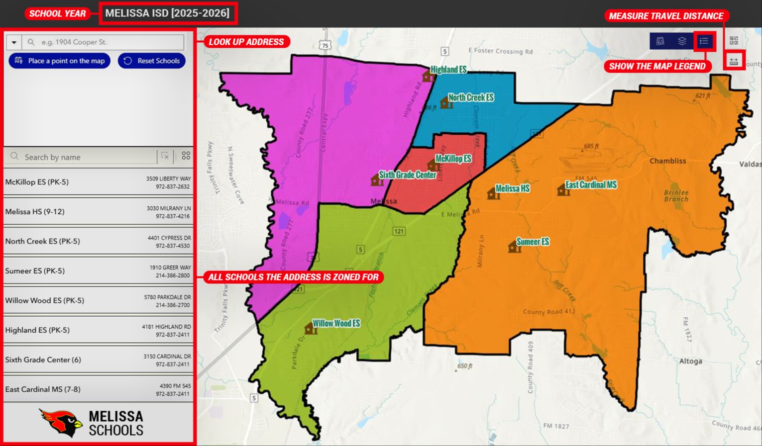
a visual of how to use the Melissa ISD interactive zoning map

The image above features a screenshot of the interactive zoning map with information for the 2023-2024 and 2024-2025 school years and labels that identify functions of the map.

By default, the interactive zoning map will show:

  • the attendance zones for all Melissa ISD elementary schools,

  • the locations of all Melissa ISD schools, and

  • general map information within the Melissa ISD attendance boundaries for the school year that is selected.

We are excited for the opportunity to partner with your family to provide a high-quality education for your child, while instilling in them our core values of integrity, loyalty, honesty, humility, and hope.